Sunday, April 14, 2024, 1:00 PM
Barking Slopes, Plum Borough, Allegheny County
Leader: Mason Heberling, heberlingm@carnegiemnh.org
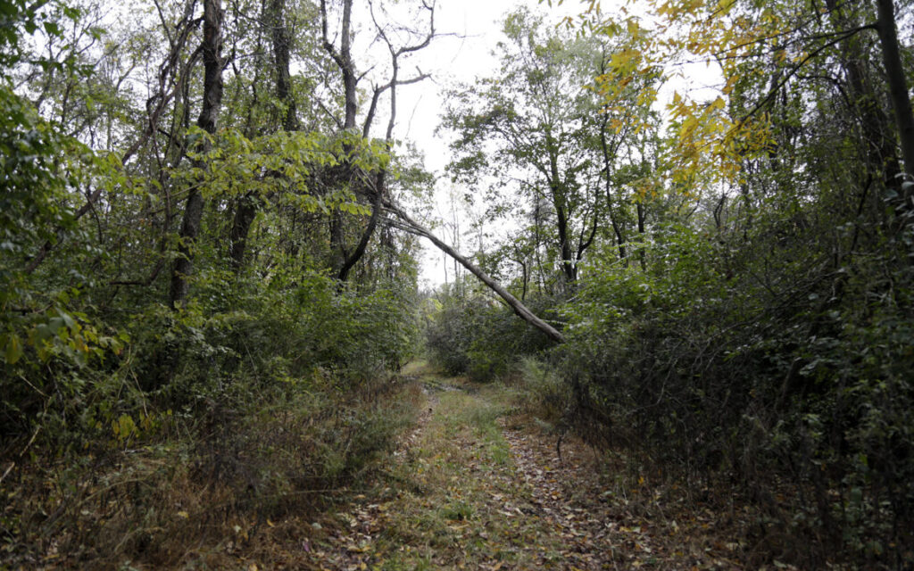
Join Mason Heberling, Assistant Curator of Botany at Carnegie Museum of Natural History, to learn about this unique natural area. The Barking Slopes Conservation Area, protected by the Allegheny Land Trust, was once a coal mine, but is now an incredibly diverse forest. Mason will introduce us to the site and discuss current research on how this forest is adapting to a changing climate and plant invasions.
Directions: From Pittsburgh, take PA Route 28 North to Exit 9(Blawnox). Merge onto Freeport Road. After 3 miles, turn right onto Hulton Bridge to enter Oakmont, and continue straight onto Hulton Road. Travel 1.5 miles to the Sheetz. At this stoplight (where Hulton Rd turns to the right), continue straight onto Coxcomb Hill Rd. Travel 3.3 miles and make a sharp left onto Barking Rd (after the Lock 3 Allegheny River sign). Travel Barking Rd 1.2 miles to parking for the preserve.
GPS coordinates: 40.53285, -79.78191 Google Map Link
Saturday, April 20, 2024, 1:00 PM
Duff Park, Murrysville, Westmoreland County
Leader: Loree Speedy; loreespeedy@gmail.com; (724) 518-6022 cell
We will meet at the new Visitor Center along US 22.
Directions: From Pittsburgh, take I-376 east (Parkway East) to its end at US 22 East – Murrysville. Travel US 22 for about 4 miles to the intersection of Trafford Rd (McDonald’s on the left). Continue along US 22 in the right lane about 7/10 of a mile. At The Fireplace and Airgas businesses, turn right into the new Robert Trail Access, where we will meet.
GPS Coordinates: 40.42699, -79.68400. Google Map Link
Monday, April 22, 2024, 1:00 PM EARTH DAY!
Great Gorge Trail , Ohiopyle State Park, Fayette County
Leader: Mark Bowers; monarda55@gmail.com; cell: (724) 454-4012
Directions: From Pittsburgh, take the PA Turnpike to Exit 91 – Donegal. Turn left onto PA 31 East and travel 2.1 miles. Turn right at a traffic light onto PA 711/ PA 381 South and continue 10 miles to a T in Normalville. Turn left onto PA 381 and continue 11 miles to Ohiopyle. Drive through the town and make a right onto SR 2019/Kentuck Road. Travel less than a half mile and turn right into the parking lot for Cucumber Falls.
GPS coordinates: 39.8629, -79.5027 Google Map Link
Saturday,April 27, 2024, 10:00 AM
Boyce Mayview Regional Park, Upper St. Clair Township, Allegheny County
Leader: Mary Ann Pike
Contact Information: cell: (412) 855-8239; mapike@earthlink.net
We will initially travel downhill to get to the riparian forest and wetlands at the bottom.
Directions: From Pittsburgh, proceed south on US 19 (Washington Road) to Boyce Road which is 3.0 miles south of South Hills Village (at Fort Couch Road). Turn right onto Boyce Road and proceed 0.5 mile to the intersection with Morton Road on the right. Turn right onto Morton Road and continue about 1.5 miles to parking for the Morton Complex on the left side of the road. Park here.
Alternatively, take I-79 south.Take Exit 54/ Bridgeville. At the end of the ramp, turn right onto Millers Run Road (PA 50) and proceed to the traffic light at the T-intersection with Washington Pike. Turn right onto Washington Pike and drive for 2.1 miles to the intersection with Boyce Road. Turn left onto Boyce and proceed 1.4 miles to the traffic light at the intersection with Mayview Road. Continue on Boyce Road for another 1.1 mile to Morton Road. Turn left onto Morton Road and continue about 1.5 miles to parking for the Morton Complex on the left side of the road. Park here.
GPS Coordinates: 40.32842, -80.09581 Google Map Link
Sunday, May 5, 2024, 1:00 PM
Sandy Creek Trail at Belmar Trailhead, Venango County
Leader: Ron Zagrocki; cell: (717) 580-5736
We will walk along the Sandy Creek Trail, winding through undeveloped and remote forest along East Sandy Creek.
Directions: The Belmar trailhead is at Belmar Village on the west side of the Allegheny River. From Exit 29 of I 80, travel PA8 North for 14.4 miles and make a right onto Pone Ln (at the first traffic light; Red Express Service Station). Travel Pone Ln for 2.4 miles and make a right at the T onto Belmar Rd, and follow it to the parking area at the foot of the hill.
GPS coordinates: 41.3333, -79.77459 Google Map Link
Saturday , May 11, 2024, 1:00 PM
Sheepskin Hollow Nature Preserve, Columbiana County, Ohio
Many people have called this the “most wild” place in all of Ohio (and it is less than a mile from the PA border!). The trail is flat but can be muddy.
Directions: From Exit 36-Brighton of I-376-Beaver Valley Expwy, turn left on Brighton Rd (if coming from south, right if coming from north) and travel a short distance to the first stop sign at Tuscarawas Rd. Turn right and travel 2.8 mile to Lisbon Rd (GCU Credit Union on corner). Turn right onto Lisbon Rd and travel 6.7 miles. (When you reach the intersection with PA 168, continue straight on Lisbon Rd). Keep a lookout for a large stand of pines on the left. At the end of the pines, turn left onto Pancake-Carlson Road. Continue 1.2 miles to the bottom of a hill. After the underpass at the bottom of the hill, look for the parking area on the right before the bridge. There is additional room to park on the side of the road near the underpass.
GPS coordinates: 40.75219, -80.53779 Google Map Link
Saturday, May 18, 2024, 1:00 PM
Oil Creek State Park, Venango County
Leader: Robert Coxe; 814-775-0005; robcoxe@gmail.com
Directions: Take I-79 north to Exit 116 to head east on I‑80. Travel I-80 east to Exit 29 Barkeyville/PA 8. Travel PA 8 north about 16 miles to Franklin. In Franklin, turn left onto 13th Street to pick up US322 West and PA 417. Travel PA 417 north 12 miles. Turn left onto PA 8 North in Cherrytree and continue about 6 1/2 miles to Titusville.
At the traffic light just before the Oil Creek bridge, turn right onto Bloss St toward Drake Well Museum. Go a mile or so to the Jersey Bridge Parking Area on the right, before the other bridge over Oil Creek. Meet at the parking lot.
We will join members of the local chapter of the Wild Ones to explore the exceptionally diverse Oil Creek Bike Trail.
GPS coordinates: 41.6159, -79.6582 Google Map Link
Sunday, May 19, 2024, 1:00 PM
Pine Ridge Park, near Blairsville, Indiana County
Leader: Loree Speedy; loreespeedy@gmail.com; (724) 518-6022 cell
Directions: From Pittsburgh, take I-376 east and US-22 east about 45 miles to Blairsville. Continue past the Walmart and the ramps for US-119, and as you proceed up the mountain, take the second right for Pine Ridge Rd. Continue a short distance to the park entrance on the left. Follow the signs for Toms Run pavilion (about 3/4 of a mile).
We will join the Botanical Society of Westmoreland County for an easy stroll and moderate climb.
GPS Coordinates: 40.44467, -79.19351 Google Map Link
Saturday, June 1, 2024, 1:00 PM
Jakes Rocks Overlook, Allegheny National Forest, Warren County
Leader: Loree Speedy; loreespeedy@gmail.com; (724) 518-6022 cell
We will join Ava Turnquist, retired Natural Resources Specialist for ANF, to botanize a hardened path through the woods holding botanical surprises in the dense vegetation. A scenic view overlooks the Jackson Bay on the Allegheny Reservoir, Kinzua Dam and the surrounding forest.
Directions: From Pittsburgh, one can reach US 6 outside of Warren, PA, by taking PA Routes 28, 36 and 666 to pick up US 6 west of Sheffield, or by taking I-80, PA Route 8 and PA Route 27 in Titusville to pick up US 6 east just west of Youngsville.
At the intersection of US Route 6 and PA 59 west of Warren, travel east on Route 59 for 10 miles. Turn right onto Longhouse National Scenic Byway and continue 1 mile . Turn right onto Forest Road 492. Travel on Forest Road 492 for 1 mile and continue on Forest Road 492 to the right when it splits and follow it to the parking area, approximately 1 mile. We will meet in the Jakes Rock Overlook parking lot, which has a vault toilet.
GPS Coordinates: 41.84867, -78.98219 Google Map Link

